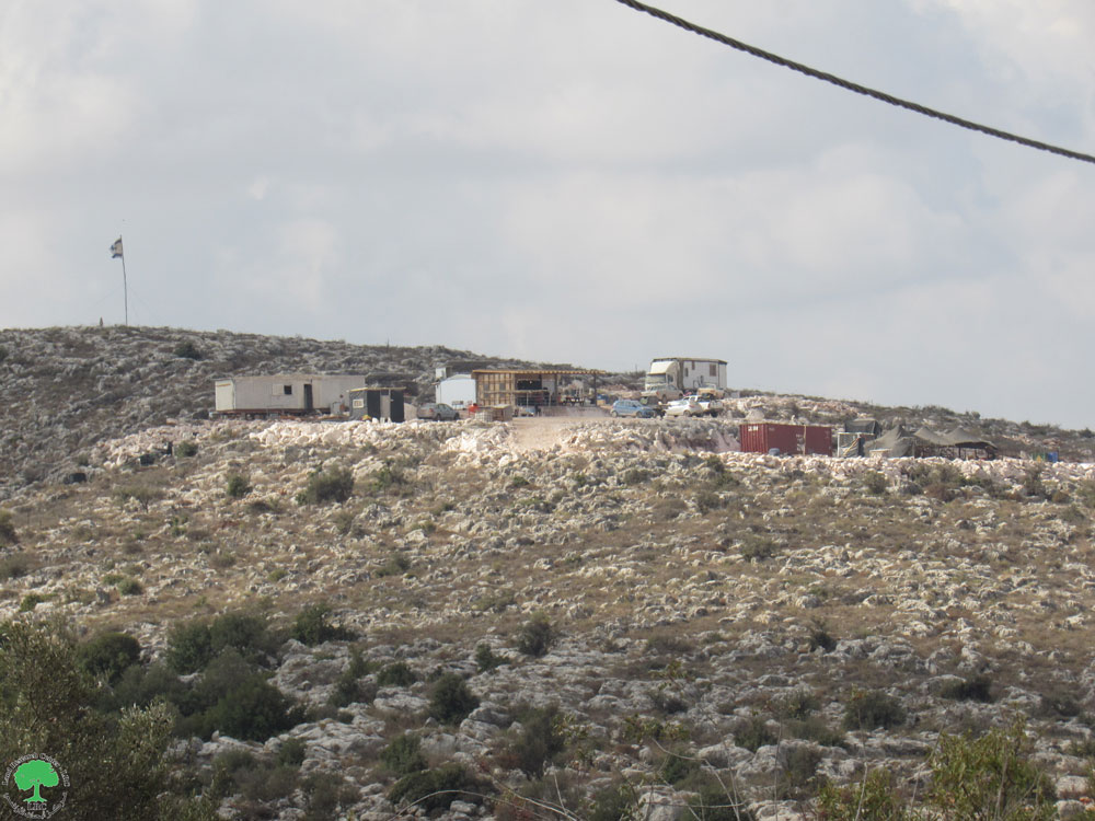
Expansion of a Settlement Outpost and Construction of a New Colonial Road on the Lands of Kafr al-Dik / Salfit Governorate
- Violation: Construction of a new colonial road and expansion of a settlement outpost.
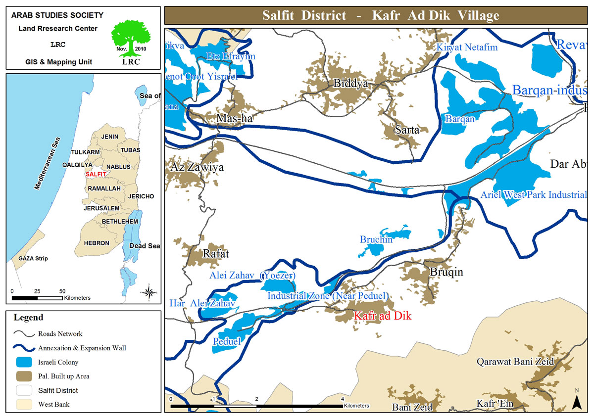
- Location: Kafr al-Dik town, west of Salfit Governorate.
- Date of Violation: October 2024.
- Perpetrators: A group of settlers.
- Affected Party: Residents of Kafr al-Dik.
Description:
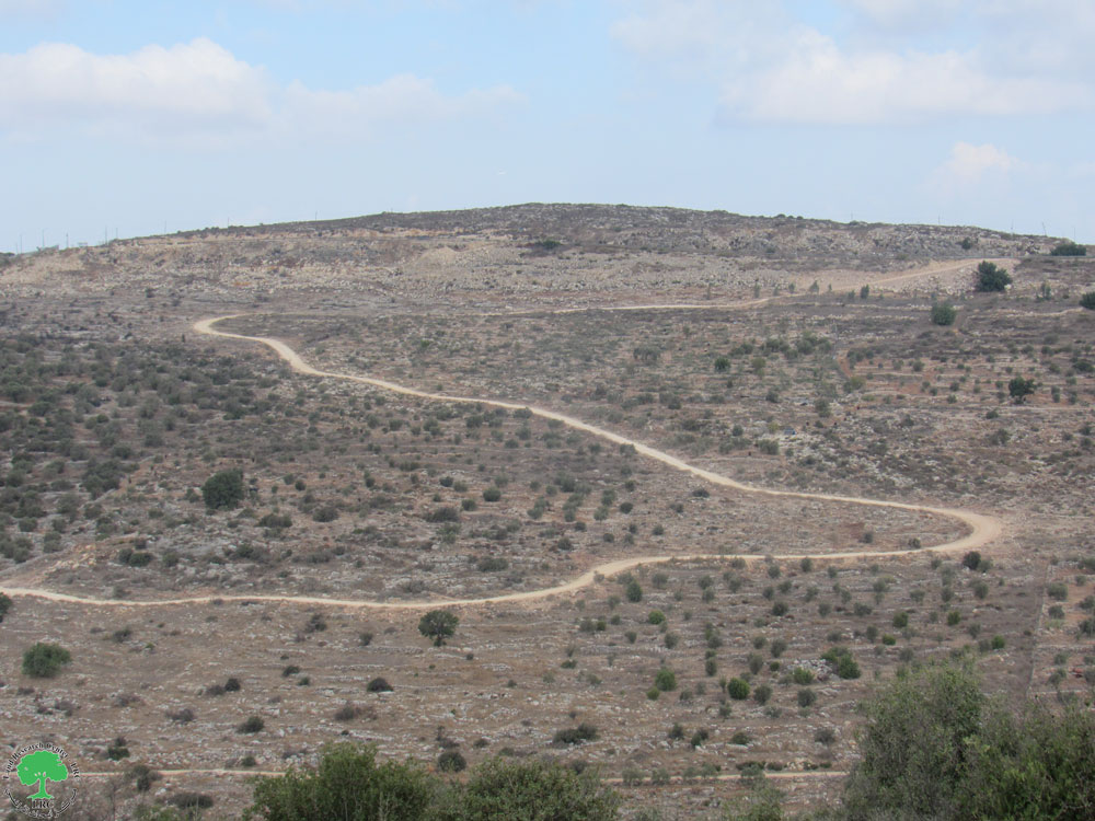
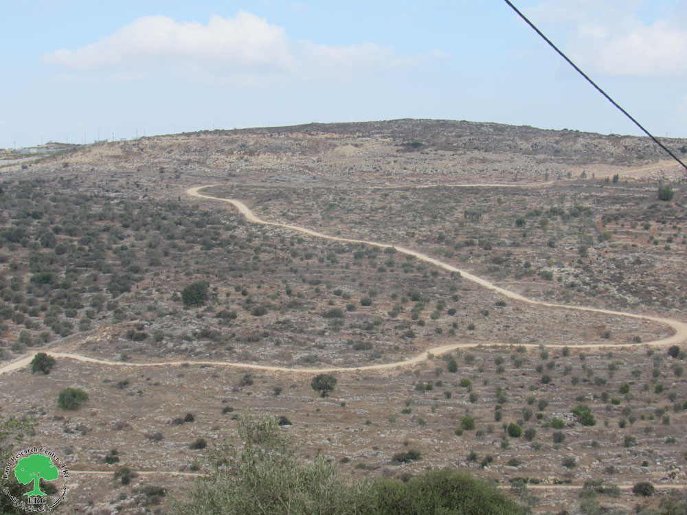
At the beginning of October 2024, coinciding with the start of the olive harvesting season, a group of settlers began constructing a colonial road to connect the newly established settlement outpost on the town's lands in the western area known as “Banat Bar” with the colonial bypass road. The road stretches for 2 kilometers in the Wadi al-Deiriyeh area, which is densely planted with productive olive trees.
It is worth noting that settlers' machinery began paving and preparing the road at the expense of lands owned mostly by the “al-Dik” and “Ali Ahmad” families from the town.
Dr. Alaa al-Dik, Mayor of Kafr al-Dik, stated:
"In light of the deteriorating security situation and the settlers' seizure of agricultural lands, the settlers exploited ongoing events. Under the protection of the occupation army and without any prior notice or confiscation warning, they constructed a 2-kilometer-long colonial agricultural road. This road starts from the colonial bypass road connecting several settlements and leads to the new outpost located to the west of the town."
The danger of this road lies in its location amidst olive fields. It is not unlikely that settlers will later resort to harassing farmers and deterring them from continuing to harvest olives.
Expansion of the New Settlement Outpost:
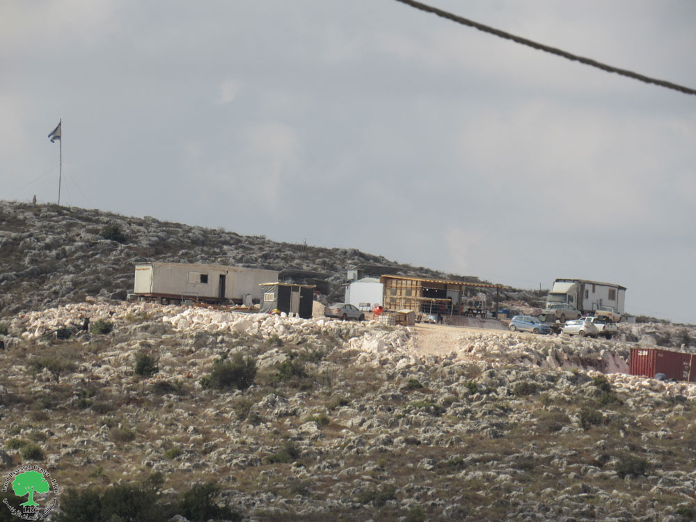
In addition to the aforementioned, settlers are relentlessly expanding the pastoral settlement outpost established on the town’s lands. So far, four new housing units have been installed, and a 9-dunam plot of land has been developed in the area. It is worth noting that the occupation classifies this land as state land.
Activist Fares al-Dik stated:
"The presence of this outpost in that location poses significant risks. The outpost essentially serves as a link between the “Bedouel” and “Ali Zahaf” settlements and the agricultural lands owned by Palestinians. This will pave the way for settlers to expand the scope of settlement activity in the area, leading to significant Judaization and alteration of its features. Furthermore, it is not unlikely that settlers will resort to attacking the surrounding olive-planted lands entirely. This will exacerbate the problem and the challenges faced by farmers."
Overview of Kafr al-Dik[1]:
Kafr al-Dik is located 15 kilometers west of Salfit city. It is bordered to the north by Bidya, to the west by the villages of Rafat and Deir Ballut, to the east by the villages of Burqin and Sarta, and to the south by the Bani Zeid villages.
As of 2017, the town's population was 5,551 residents, and its total area is 15,529 dunams, of which 791 dunams constitute the built-up area of the village.
The occupation has confiscated 2,477 dunams of its land, detailed as follows:
The settlements have seized 1,225 dunams of the village's land, which includes:
Colony Name | Established year | Area of confiscated land/dunums | Number of colonists |
Har Eli zahaf | 1983 | 134 | NA |
Eli Zajaf-youezar | 1982 | 290 | 424 |
Badouel | 1984 | 800 | 1088 |
Brokhen | 1999 | 1 | NA |
Total |
| 1225 | 1512 |
The bypass roads have seized 362 dunams.
The apartheid wall has confiscated 890 dunams under its route and will isolate approximately 8,842 dunams behind it. The wall stretches 8,905 meters on the village’s lands.
According to the Oslo Accords, the lands of Kafr al-Dik are classified as follows:
- Area B: 15% of the village’s land, equivalent to 2,252 dunams.
- Area C: Under full Israeli control, constituting 85% of the land, equivalent to 13,277 dunams.
United Nations General Assembly Resolutions on Settlements
- The United Nations General Assembly resolution of December 20, 1972, in which it demanded that Israel cease a number of actions and practices, including (the construction of Israeli settlements in the occupied Arab territories and the transfer of some civilian populations from Israel to the occupied Arab territories).
- The United Nations General Assembly resolution of December 15, 1972, in which the General Assembly requested that Israel cease annexing any part of the occupied Arab territories, establish settlements in those territories, and transfer populations to them..
- The United Nations General Assembly resolution of December 7, 1973, in which the General Assembly expressed grave concern over Israel's violation of the provisions of the Fourth Geneva Convention of 1949 and all measures taken by Israel to alter the features of the occupied territories or their demographic composition, considering them a violation of international law.
- The General Assembly resolution of November 29, 1974, in which the General Assembly expressed its utmost concern about Israel's annexation of parts of the occupied territories, the establishment of settlements, and the transfer of populations to them.
- The United Nations General Assembly resolution of December 15, 1975, consisting of four sections, in which the first section condemned all actions carried out by Israel in the occupied territories, describing these practices as serious violations of the United Nations Charter and an obstacle to the establishment of a lasting and just peace in the region. It emphasized that these actions are considered null and void and have no basis in legality.
- The United Nations General Assembly resolution of October 28, 1977, which affirmed in its first paragraph that all measures and actions taken by Israel in the Palestinian territories and other Arab territories occupied since 1967 are legally invalid, and constitute a serious obstacle to efforts aimed at achieving a just and lasting peace in the Middle East. The General Assembly also expressed strong regret over Israel's continued implementation of these measures, particularly the establishment of settlements in the occupied Arab territories.
Source: GIS Unit – LRC.
مشروع: حماية الحقوق البيئية الفلسطينية في مناطق "ج" SPERAC V - FCDO
Disclaimer: The views and opinions expressed in this report are those of Land Research Center and do not necessarily reflect the views or positions of the project donor; the Norwegian Refugee Council.
إخلاء المسؤولية: الآراء ووجهات النظر الواردة في هذا التقرير هي آراء ووجهات نظر مركز أبحاث الأراضي ولا تعكس بالضرورة وجهات نظر أو مواقف الجهة المانحة للمشروع؛ المجلس النرويجي. للاجئين
